Origins of Robin Hood the likeable rogue rumored King Richard army deserter 360-s vr locations
Link Location Gps ← Find Best directions
Gps Coordinates / 53.1978504,-1.0672053
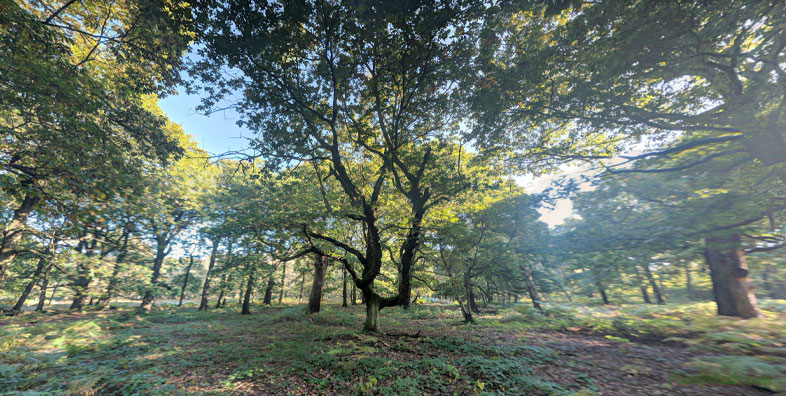
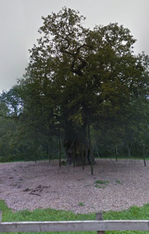
Sherwood Forest Robin Hood Famous Map Locations
Sherwood Forest, Edwinstowe, Mansfield NG21 9RN
taken arms against his disillusionment of theocratic theology of druids, bishops, high priests and even their king that was overstepping its bounds into his personal sovereignty to oppression of his local community, long may you live in interesting times.
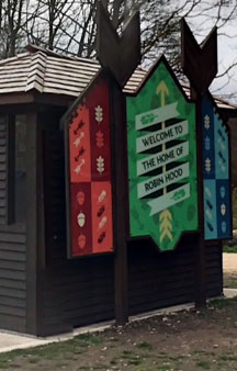
Robin Hood information centre for lessons what to do when governments turn tyrannical in favour for theocratic rule upon thee
Gps Coordinates / 53.1980547,-1.0669959
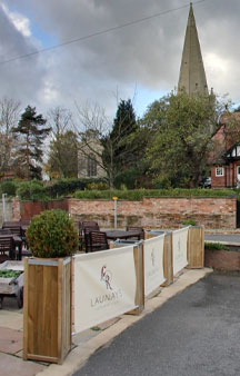
St Mary's Church, Edwinstowe is a Grade I listed parish church in the Church of England
The Boundary Wall, Gate, Steps And Overthrow At Church Of St Mary are also Grade II listed by the Department for Digital, Culture, Media and Sport. The church dates from around 1175. It was restored in 1869 and 1890.
Not many hotels can boast about overlooking a mccabe creepy cemetery yet its the church thats most famous but i’m sure the graveyard situated around this church has more than a few secrets buried beneath her, its is the mystery afterall that gives Sherwood
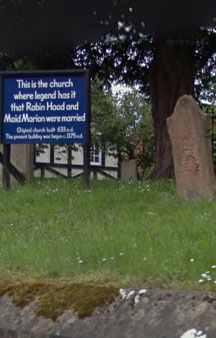
Church of St Mary
This is the church where legend has it that Robin Hood and Maid Marion were married.
Original Church built 633 a.d
The present building was began c.1175 a.d
Link Location Gps / Link Gps -1.0664838 / Link Gps -1.0664729 / Link Gps -1.0648214
Gps Coordinates / 53.1988038,-1.0664838 / 53.1974093,-1.0664729 / 53.1958709,-1.0648214
Romantic tourist destination for the more adventurous discussions of woo’ing the beautiful Maid Marian and thwarts the evil Sheriff of Nottingham would be a regular point of discussion within these hotels
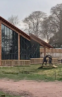
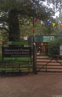
Craft Shops, amusements and Pathways at the entrance of Sherwood Forest, no real need to point out sherwood forest is a national nature reserve but it only seems like temporary as the population of Britain explodes so will the decline of most nature reserves
Link Location Gps / Link Gps -1.0645544 / Link Gps -1.0645321 / Link Gps -1.0668695
Gps Coordinates / 53.1960447,-1.0645544 / 53.1959282,-1.0645321 / 53.197816,-1.0668695
Ideal trip for the imagination which is a great activity for kids as they have vivid imaginations, a great way to develop a kids imagination by taking them to places that inspired the much loved Peter Pan.
Link Location Gps / Link Gps -1.0684175 / Link Gps -1.0692883 / Link Gps -1.0716732
Gps Coordinates / 53.1995177,-1.0684175 / 53.2001991,-1.0692883 / 53.201915,-1.0716732
Use your imagination and imagine Kings, Knights, corrupt sheriffs, Bishops and horse convoys of soldiers trying to trap the dreaded traitor of King Lion Heart, all spreading information to reign in this anti-god rogue deserter, using every instrument of London at their disposal even perhaps being the lead protagonist for the need of a printing press in France to publicize his victories more efficiently. France did love a good bad news day in Britain, he really could have been what inspired the invention of the famed Printing Press.
Link Location Gps / Link Gps -1.0724343 / Link Gps -1.0726807 / Link Gps -1.073148
Gps Coordinates / 53.2043226,-1.0724343 / 53.2045313,-1.0726807 / 53.2049411,-1.073148
Sherwood is no longer as fertile and lush as it once were its more of a mini recreation of what it once was but the history and spirits will always remain with the local nature reserve trying to breathe the old familiarness for tourists to enjoy, recreating the past by protecting trees and forested areas is something most people could approve of.
Link Location Gps / Link Gps -1.0727578 / Link Gps -1.0711369 / Link Gps -1.0660447
Gps Coordinates / 53.2050197,-1.0727578 / 53.2054852,-1.0711369 / 53.2035573,-1.0660447
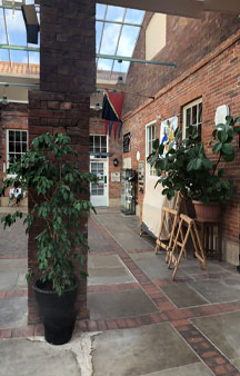
Sherwood information centre with cafes, artwork, activities and exhibitions with the odd pantomime play schedules for the kids
Link Location Gps / Link Gps -1.0641653 / Link Gps -1.0636855 / Link Gps -1.063464
Gps Coordinates / 53.2031299,-1.0641653 / 53.2030215,-1.0636855 / 53.2026265,-1.063464
Terrain views of the local area with the local towns like Edwinstowe in the background that has, lodges, leisure complexes, trekking centres and comforts you’d expect from a small town with medieval english history dating further back than Robert Loxley of Sherwood
Link Location Gps / Link Gps -1.0669433 / Link Gps -1.0636535 / Link Gps -1.0667517
Gps Coordinates / 53.2020519,-1.0669433 / 53.2032136,-1.0636535 / 53.2117818,-1.0667517
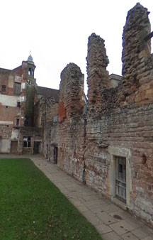
12th-Century Cistercian Abbey
Link Location Gps / Link Gps -1.0354945 / Link Gps -1.0357465 / Link Gps -1.035673
Gps Coordinates / 53.1765917,-1.0354945 / 53.1762687,-1.0357465 / 53.176046,-1.035673
The Cistercians, officially the Order of Cistercians, are a Catholic religious order of monks and nuns that branched off from the Benedictines and follow the Rule of Saint Benedict. They are also known as Bernardines, after the highly influential Bernard of Clairvaux or as White Monks, in reference to the colour of the choir robe worn by the Cistercians over their habits, as opposed to the black robe worn by Benedictines.
Aerial View of Sherwood Forest


