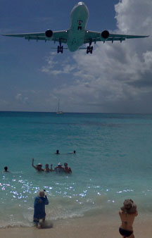
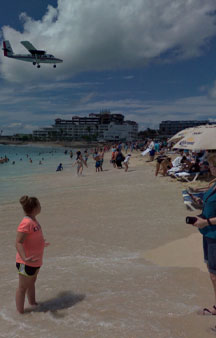
Plane Runway Beach flight passenger attraction in these Panoramic VR pictures
Link Location Gps ← Find Best directions
Gps Coordinates / 18.0398043,-63.1206661
Plane Danger Beach Maho St Maarten Tourism VR Map Links
Beacon Hill Road, Simpson Bay, Sint Maarten
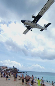
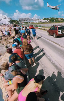
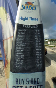
Due to the unique proximity of low flying airliners, the location is very popular with plane spotters. This is one of the few places in the world where aircraft can be viewed in their flight path just outside the end of the runway. Watching airliners pass over the beach is such a popular activity that daily arrivals and departures airline timetables are displayed on a board in most bars and restaurants on the beach, and the Sunset Bar and Grill formerly had a speaker on its outside deck that broadcast radio transmissions between pilots and the airport's control tower. The speaker was no longer in use by August 2015.(citation needed)
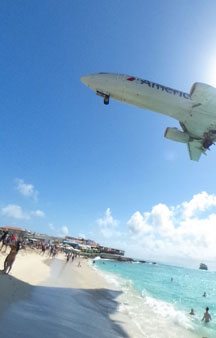
Maho Beach is unusually close to the threshold of a runway, and is directly under the flight path, resulting in aircraft on their final approach flying over the beach at altitudes of less than 100 feet above ground level.
Danger Sign
Link Location Gps / Gps Link -63.1203064 / Gps Link -63.120206 / Gps Link -63.1201912
Gps Coordinates / 18.0394492,-63.1203064 / 18.038782,-63.120206 / 18.0383835,-63.1201912
There is a danger of people standing on the beach being blown into the water because of the jet blast from aircraft taking off from runway 10. The local government warns that closely approaching and departing aircraft can "result in serious injury and/or death". An additional fence has been added recently behind runway 10, in order to prevent people from hanging onto the main fence surrounding the runway to experience being blasted by the jet flow.
GPS Coordinates / 18.039344,-63.1202759
The beach itself is white sand and has little to no vegetation because of jet blast erosion. The Caravanserai Resort, the Sunset Bar and other restaurants/night clubs such as Bamboo Bernies and Bliss are located nearby. The beach is popular with windsurfers and skimboarders because of occasional large waves.
GPS Coordinates / 18.0391674,-63.1202774
Link Location Gps / Gps Link -63.1208828 / Gps Link -63.1207614 / Gps Link -63.1207042
Gps Coordinates / 18.0400525,-63.1208828 / 18.0400386,-63.1207614 / 18.0399579,-63.1207042
Aerial View Location of the Dangerous Plane beach, the inhaling of the fumes can’t be too healthy for you either
Aerial View Of Plane Danger Beach Maho St Maarten
This popular controversial Tourist spot area usually gets on the news for being well! controversial
{youtube}https://www.youtube.com/watch?v=z3vxFTjC1SM{/youtube}


