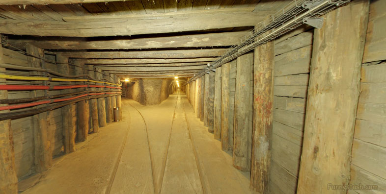
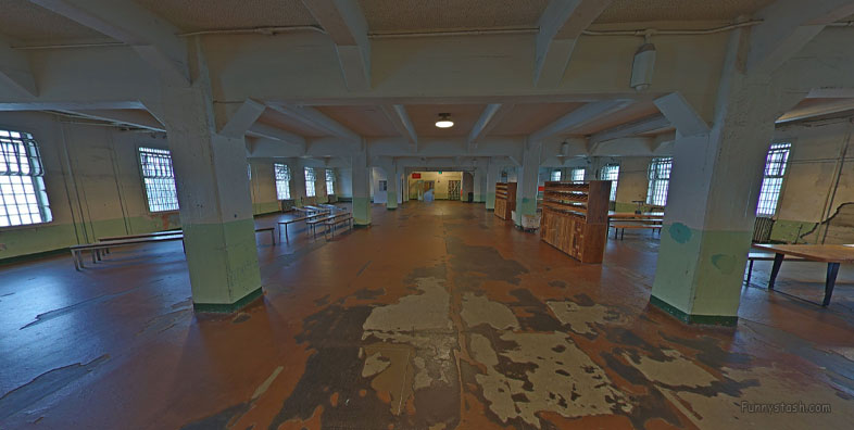
13th Century Polish Salt mine UNESCO World Heritage Site protection 360-s vr locations
Link Location Gps ← Find Best directions
Gps Coordinates / 49.9830492,20.0548714
Wieliczka Salt Mine Poland 13th Century Tourism Directions
Daniłowicza 10, 32-020 Wieliczka, Poland
From Neolithic times, sodium chloride (table salt) was produced there from the upwelling brine. The Wieliczka salt mine, excavated from the 13th century, produced table salt continuously until 2007, as one of the world's oldest operating salt mines. Throughout its history, the royal salt mine was operated by the Żupy Krakowskie (Kraków Salt Mines) company.
Gps Coordinates / 49.9833527,20.055813
Due to falling salt prices and mine flooding, commercial salt mining was discontinued in 1996. The Wieliczka Salt Mine is now an official Polish Historic Monument (Pomnik Historii) and a UNESCO World Heritage Site. Its attractions include the shafts and labyrinthine passageways, displays of historic salt-mining technology, an underground lake, four chapels and numerous statues carved by miners out of the rock salt, and more recent sculptures by contemporary artists.
buy tickets here to go very deep, this virtual tour has leift levels at the bottom right of your screen to explore
Link Gps Location Gps / Link Gps 49.9831577 / Link Gps 49.9830972 / Link Gps 49.9830765
Gps Coordinates / 49.9831577,20.0556059 / 49.9830972,20.0557615 / 49.9830765,20.0557552
The Wieliczka Salt Mine reaches a depth of 327 meters, and extends via horizontal passages and chambers for over 178 miles. The rock salt is naturally of varying shades of grey, resembling unpolished granite rather than the white crystalline substance that might be expected.
Its easy to forget that this is real and not a fake amusment presentation but a real working salt mine where people once lived died and prayed
Link Gps Location Gps / Link Gps 49.9830357 / Link Gps 49.9831256 / Link Gps 49.9833117
Gps Coordinates / 49.9830357,20.0543947 / 49.9831256,20.0542069 / 49.9833117,20.0545347
Since the 13th century, brine welling up to the surface had been collected and processed for its sodium chloride (table-salt) content. In this period, wells began to be sunk, and the first shafts to be dug to extract the rock salt. In the late 13th to the early 14th century, the Saltworks Castle was built. Wieliczka is now home to the Kraków Saltworks Museum.
Salt mines had historical importance, before freezers with preservatives. Salt mines determined succesful cultures and armies as salt could transport food for long durations and was heavily politizized even in medieval times, the cultures who had salty mines prospored as export nations and base operations
Link Gps Location Gps / Link Gps 49.9833282 / Link Gps 49.9832387 / Link Gps 49.9832697
Gps Coordinates / 49.9833282,20.0548789 / 49.9832387,20.055048 / 49.9832697,20.0551838
King Casimir III the Great (reigned 1333–1370) contributed greatly to the development of the Wieliczka Salt Mine, granting it many privileges and taking the miners under his care. In 1363 he founded a hospital near the salt mine.
Link Gps Location Gps / Link Gps 49.9830686 / Link Gps 49.9829457 / Link Gps 49.9829233
Gps Coordinates / 49.9830686,20.055333 / 49.9829457,20.0555214 / 49.9829233,20.0555669
Over the period of the mine's operation, many chambers were dug and various technologies were added, such as the Hungarian horse treadmill and the Saxon treadmill for hauling salt to the surface. During World War II, the mine was used by the occupying Germans as an underground facility for war-related manufacturing.
Link Gps Location Gps / Link Gps 49.9838659 / Link Gps 49.9827193 / Link Gps 49.9828146
Gps Coordinates / 49.9838659,20.0538563 / 49.9827193,20.0545357 / 49.9828146,20.0544557
The mine features an underground lake, exhibits on the history of salt mining, and a 2.2-mile visitors route (less than 2 percent of the mine passages total length) including statues carved from the rock salt at various times.
Link Gps Location Gps / Link Gps 49.9828064 / Link Gps 49.9828439 / Link Gps 49.9827728
Gps Coordinates / 49.9828064,20.0543037 / 49.9828439,20.0543732 / 49.9827728,20.0542403
In 1978 the Wieliczka Salt Mine was placed on the original UNESCO list of World Heritage Sites.
Link Gps Location Gps / Link Gps 49.9826879 / Link Gps 49.9825991 / Link Gps 49.9825674
Gps Coordinates / 49.9826879,20.0540738 / 49.9825991,20.0538843 / 49.9825674,20.0538579
A legend about Princess Kinga, associated with the Wieliczka mine, tells of a Hungarian princess about to be married to Bolesław V the Chaste, the Prince of Kraków. As part of her dowry, she asked her father, Béla IV of Hungary, for a lump of salt, since salt was praiseworthy in Poland. Her father King Béla took her to a salt mine in Máramaros. She threw her engagement ring from Bolesław in one of the shafts before leaving for Poland. On arriving in Kraków, she asked the miners to dig a deep pit until they come upon a rock. The people found a lump of salt in there and when they split it in two, discovered the princess's ring. Kinga had thus become the patron saint of salt miners in and around the Polish capital.
many churches within this salt mine, many popes would visit this salt mine making this an area of interest for religious followers
Link Gps Location Gps / Link Gps 49.9825991 / Link Gps 49.9830581 / Link Gps 49.9830282
Gps Coordinates / 49.9825991,20.0538843 / 49.9830581,20.0553133 / 49.9830282,20.0553263
During the Nazi occupation, several thousand Jews were transported from the forced labour camps in Plaszow and Mielec to the Wieliczka mine to work in the underground armament factory set up by the Germans in March and April 1944. The forced labour camp of the mine was established in St. Kinga Park and had about 1,700 prisoners. However, manufacturing never began as the Soviet offensive was nearing. Some of the machines and equipment were disassembled, including an electrical hoisting machine from the Regis Shaft, and transported to Liebenau in the Sudetes mountains. Part of the equipment was returned after the war, in autumn 1945. The Jews were transported to factories in Litomierzyce (Czech Republic) and Linz (Austria).
alot of equipment under this salt mine would be used even had wheels in the lounge area where miners could keep an eye on production whilst lounging
Link Gps Location Gps / Link Gps 49.9830377 / Link Gps 49.9829249 / Link Gps 49.9827741
Gps Coordinates / 49.9830377,20.0550662 / 49.9829249,20.0550447 / 49.9827741,20.0549848
The mine is one of Poland's official national Historic Monuments, as designated in the first round, 16 September 1994. Its listing is maintained by the National Heritage Board of Poland. In 2010 it was successfully proposed that the nearby historic Bochnia Salt Mine (Poland's oldest salt mine) be added to the list of UNESCO World Heritage sites. The two sister salt mines now appear together in the UNESCO list of World Heritage Sites as the "Wieliczka and Bochnia Royal Salt Mines". In 2013 the UNESCO World Heritage Site was expanded by the addition of the Żupny Castle.
Link Gps Location Gps / Link Gps 49.9830492 / Link Gps 49.9830661
Gps Coordinates / 49.9830492,20.0548714 / 49.9830661,20.0546305
Attractions include dozens of statues and four chapels carved out of the rock salt by the miners. The older sculptures have been supplemented with new carvings made by contemporary artists. About 1.2 million people visit the Wieliczka Salt Mine annually.
Notable visitors to this site have included Nicolaus Copernicus, Johann Wolfgang von Goethe, Alexander von Humboldt, Fryderyk Chopin, Dmitri Mendeleyev, Bolesław Prus, Ignacy Paderewski, Robert Baden-Powell, Jacob Bronowski (who filmed segments of The Ascent of Man in the mine), the von Unrug family (a prominent Polish-German royal family), Karol Wojtyła (later, Pope John Paul II), former U.S. President Bill Clinton, and many others.
There is a chapel, and a reception room that is used for private functions, including weddings. A chamber has walls carved by miners to resemble wood, as in wooden churches built in early centuries. A wooden staircase provides access to the mine's 210-foot level. A 1.9-mile tour feature corridors, chapels, statues, and underground lake, 443 ft underground. An elevator returns visitors to the surface, the elevator holds 36 persons (nine per car) and takes about 30 seconds to make the trip.
Location Direction Gps 49.9832974
Gps Coordinates / 49.9832974,20.0555161
Buy your attraction tickets here below


