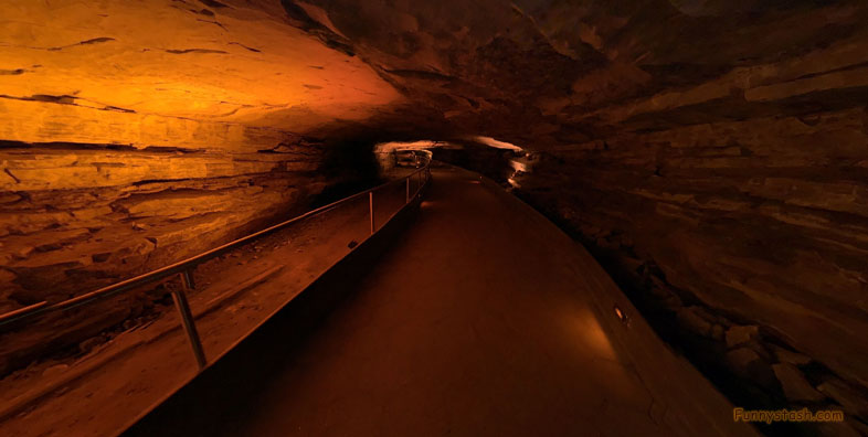
The longest cave system known in the world an American national park in west-central Kentucky
Link Location Gps ← Find Best directions
Gps Coordinates / 37.1870743,-86.1024097
Mammoth Cave National Park VR Kentucky
1 Mammoth Cave Pkwy, Mammoth Cave, KY 42259, United States
The park was established as a national park on July 1, 1941. Mammoth Cave is the world's longest known cave system with more than 420 miles of surveyed passageways, which is nearly twice as long as the second-longest cave system as Mexico's Sac Actun underwater cave
Labelled World Heritage Site on October 27, 1981
Gps Coordinates / 37.1854464,-86.0988277
The park's 52,830 acres (21,380 ha) are located primarily in Edmonson County, with small areas extending eastward into Hart and Barren counties. The Green River runs through the park, with a tributary called the Nolin River feeding into the Green just inside the park.
Link Location Gps / Gps Link -86.1012007 / Gps Link -86.1011949 / Gps Link -86.0736764
Gps Coordinates / 37.1860898,-86.1012007 / 37.1868201,-86.1011949 / 37.1976117,-86.0736764
The purpose of Mammoth Cave National Park is to preserve, protect, interpret, and study the internationally recognized biological and geologic features and processes associated with the longest known cave system in the world, the park’s diverse forested, karst landscape, the Green and Nolin rivers, and extensive evidence of human history, and to provide and promote public enjoyment, recreation, and understanding.
Labelled international Biosphere Reserve on September 26, 1990
Link Location Gps / Gps Link -86.1034441 / Gps Link -86.1042274 / Gps Link -86.1045875
Gps Coordinates / 37.1866958,-86.1034441 / 37.1865106,-86.1042274 / 37.1864579,-86.1045875
An exception to purposeful burial was discovered when in 1935 the remains of an adult male were discovered under a large boulder. The boulder had shifted and settled onto the victim, a pre-Columbian miner, who had disturbed the rubble supporting it.
Link Location Gps / Gps Link -86.1069228 / Gps Link -86.1069142 / Gps Link -86.1050045
Gps Coordinates / 37.1871843,-86.1069228 / 37.1871658,-86.1069142 / 37.1863402,-86.1050045
The remains of the ancient victim were named "Lost John" and exhibited to the public into the 1970s, when they were interred in a secret location in Mammoth Cave for reasons of preservation as well as emerging political sensitivities with respect to the public display of Native American remains.
Labelled International Dark Sky Park on October 28, 2021.
Link Location Gps / Gps Link -86.1052554 / Gps Link -86.1011639 / Gps Link -86.103309
Gps Coordinates / 37.1867927,-86.1052554 / 37.1873344,-86.1011639 / 37.187255,-86.103309
Research beginning in the late 1950s led by Patty Jo Watson, of Washington University in St. Louis has done much to illuminate the lives of the late Archaic and early Woodland peoples who explored and exploited caves in the region.
The story of human beings in relation to Mammoth Cave spans five thousand years.
Link Location Gps / Gps Link -86.1028274 / Gps Link -86.103366 / Gps Link -86.1057953
Gps Coordinates / 37.1860428,-86.1028274 / 37.187282,-86.103366 / 37.1884451,-86.1057953
Several sets of Native American remains have been recovered from Mammoth Cave
Link Location Gps / Gps Link -86.1015753 / Gps Link -86.108907 / Gps Link -86.1089822
Gps Coordinates / 37.1871123,-86.1015753 / 37.1871512,-86.108907 / 37.1870519,-86.1089822
This analysis indicates a timed transition from a hunter-gatherer culture to plant domestication and agriculture.
Link Location Gps / Gps Link -86.1092201 / Gps Link -86.1031444
Gps Coordinates / 37.179037,-86.1092201 / 37.187391,-86.1031444
Preserved by the constant cave environment, dietary evidence yielded carbon dates enabling Watson and others to determine the age of the specimens. An analysis of their content, also pioneered by Watson, allows determination of the relative content of plant and meat in the diet of either culture over a period spanning several thousand years.


