Arsameia was a royal seat of the kingdom of Commagene of King Mithridates I Kallinikos
Link Location Gps ← Find Best directions
Gps Coordinates / 37.9460526,38.6550371
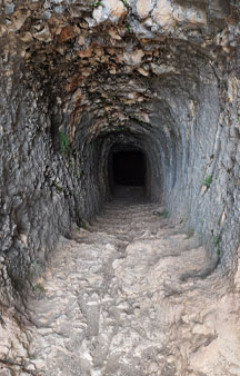
Arsameia 2bc Ancient Cave-Tombs-Fortress VR Turkey Tourism Locations
02400 Kocahisar/Kâhta/Adıyaman, Turkey
It was then taken in 235 BCE by the Seleukid Antiochus Hierax who was fleeing from his brother Seleucus II, who was later claimed as an ancestor by the Commagenian King Antiochus I. The city had already been abandoned again by Roman times, stones from local graves were used by Roman soldiers or building bridges.
-
The ancient town of Nymphaios was renamed Arsameia in the third century BCE by the Armenian king Arsames (255–225 BCE).
Gps Coordinates / 37.9460566,38.6549999
A processional way leads up the mountain in the form of a Z and passes three sites which its discoverer Friedrich Karl Dörner marked as Sites I–III. At the first of these, Site II, stands the fragment described as the Mithras relief. It is the right hand side of a dexiosis, which shows Antiochos or Mithridates shaking hands with the sun god Mithras.
King Mithridates or Antiochus I of Commagene shaking hands with Heracles
Link Location Gps / Gps Link 37.9433833 / Gps Link 37.9460752 / Gps Link 37.9433044
Gps Coordinates / 37.9433833,38.6560167 / 37.9460752,38.6549846 / 37.9433044,38.6559308
The path leads on further to Site III. Here on a wall of rock was found an inscription of Antiochos in five columns, in which he relates the story of how the city was founded and the building of the Hierothesion as well as detailed instructions about how to carry out the rites that needed to be performed.
Link Location Gps / Gps Link 37.9460766 / Gps Link 37.9460437 / Gps Link 37.9460777
Gps Coordinates / 37.9460766,38.655043 / 37.9460437,38.6550073 / 37.9460777,38.655031
Since the inscription had been almost completely covered in earth from ancient times it is still in an amazing condition. In the lower part of the inscribed wall a walkway begins that goes steeply up the rock and then suddenly ends after 158 metres. Nothing is known about its purpose. Above the wall stands the best preserved dexiosis relief of Commagene. It shows one of the two kings, either Antiochos or Mithridates shaking hands with a naked Herakles, recognizable from his club.
Link Location Gps / Gps Link 37.9427852 / Gps Link 37.9492335
Gps Coordinates / 37.9427852,38.6566336 / 37.9492335,38.6538883
The processional way leads further beyond this site as far as the summit of the mountain. There was found the foundations of buildings with mosaic flooring, which can be dated back to the Second Century before Christ. On the basis of fragments of sculpture Dörner takes it that this is where the mausoleum of Mithridates stood, decorated with statues.
The Greek word hierothesion is term for the holy burial areas belonging to royal house, and is only known from Commagene.
Gps Coordinates / 37.9430405,38.6553155
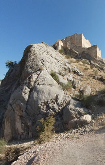
About two kilometers away, on the other side of the Kahtacay, lies the fortress of Yenikale ("New Castle"). Here according to the inscription at Site III lay the Palace buildings of the Commagenian rulers.
Gps Coordinates / 37.9453075,38.6516117
Field Of Iron. To the west of the two mountains of Yenikale and Eskikale Dörner and his colleague Wilhelm Winkelmann discovered an area of iron smelting, the first in Commagene. The remains of furnace walls, bits of slag, salamanders (the remains of pig iron left when smelting), as well as sharp pieces and coins.
Gps Coordinates / 37.9487618,38.6536181
-
An earlier building had already been conquered and destroyed in 1286 by Kara Sonkar, the governor of Aleppo. A path leads from the lower part of the castle on the side of the river to a building known as the "Pigeon Castle", which is positioned under an overhanging ledge of rock. It was used to provide water to the castle, as well as relaying it over a bridge to the Eski Kale.


