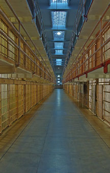
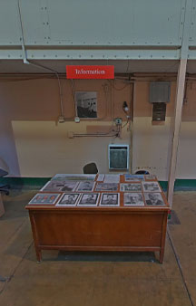
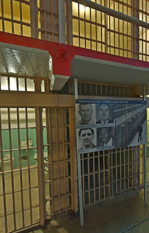
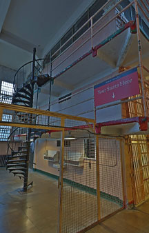
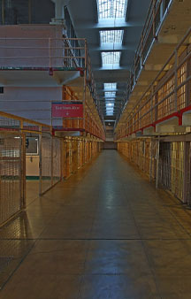
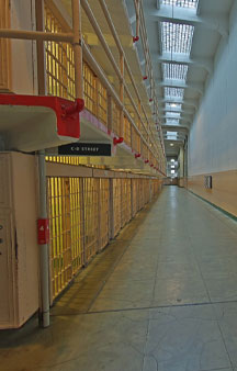
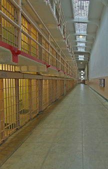
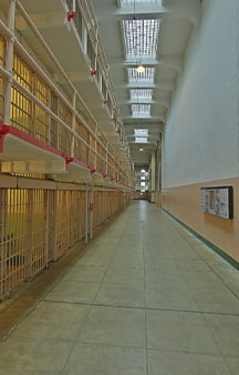
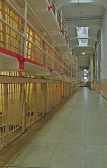
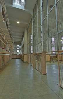
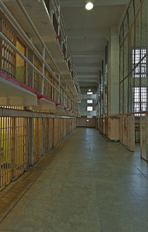
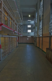
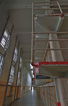
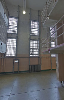
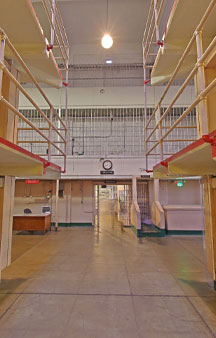
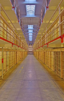
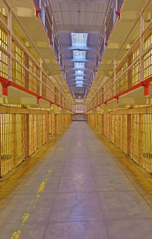
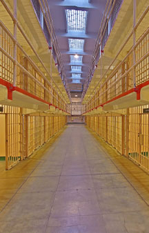
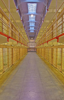
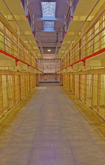
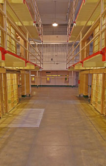
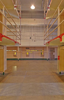
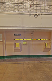
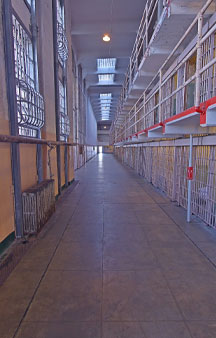
Main Cell House Level 1 known as B and C block, Most new inmates at Alcatraz were assigned to the second tier of B-Block. They had "quarantine status" for their first three months.
Link Location Gps ← Find Best directions
Gps Coordinates / 37.8268069,-122.4230794
Alcatraz Prison Cell House 2013 2015 VR Alcatraz Island
Alcatraz Main Cell House, Pier 39, San Francisco, CA 94133, USA
The most heavily trafficked corridor was "Broadway" between B and C Block, due to its being the central corridor of the prison and passed not only by guards but other prison workers.
The main prison building was built in 1910–12 as a U.S. Army military prison.
Link Location Gps -122.4231244
Gps Coordinates / 37.8267523,-122.4231244
After being locked in for the night, 6 guards usually patrolled the four cell blocks.
Link Location Gps / Gps Link -122.4225495 / Gps Link -122.4225257 / Gps Link -122.42309
Gps Coordinates / 37.8264791,-122.4225495 / 37.8265131,-122.4225257 / 37.826777,-122.42309
Inmates were permitted one visitor a month, although anybody likely to cause trouble such as registered criminals were barred from visiting.
Link Location Gps / Gps Link -122.4227168 / Gps Link -122.4227461 / Gps Link -122.4227759
Gps Coordinates / 37.8266629,-122.4227168 / 37.8266875,-122.4227461 / 37.8267135,-122.4227759
Frank Morris and his fellow escapees escaped Alcatraz during the June 1962 escape from Alcatraz by entering a utility corridor behind B-Block.
Link Location Gps / Gps Link -122.4228072 / Gps Link -122.4228389 / Gps Link -122.4228694
Gps Coordinates / 37.8267401,-122.4228072 / 37.8267675,-122.4228389 / 37.8267943,-122.4228694
The three-story cellhouse included the four main cell blocks – A-block through D-block, the warden's office.
Link Location Gps / Gps Link -122.4229015 / Gps Link -122.4231548 / Gps Link -122.4231212
Gps Coordinates / 37.8268233,-122.4229015 / 37.8267289,-122.4231548 / 37.826692,-122.4231212
Many prisoners have compared their duration at Alcatraz to hell and would have preferred death to continued incarceration.
Link Location Gps / Gps Link -122.4230913 / Gps Link -122.4230648 / Gps Link -000.000
Gps Coordinates / 37.826669,-122.4230913 / 37.8266466,-122.4230648 / 37.8266233,-122.4230377
In June 1934, the Teletouch Corporation of New York began the installation of an "electro-magnetic gun or metal detecting system" at Alcatraz.
Link Location Gps / Gps Link -122.4230022 / Gps Link -122.4229749 / Gps Link -122.4229506
Gps Coordinates / 37.8265917,-122.4230022 / 37.8265684,-122.4229749 / 37.8265467,-122.4229506
Detectors were added on the wharf, at the front entrance into the cellblock, and at the rear entrance gate.
Link Location Gps / Gps Link -122.4229261 / Gps Link -122.4228977 / Gps Link -122.4228398
Gps Coordinates / 37.8265244,-122.4229261 / 37.8264992,-122.4228977 / 37.8264514,-122.4228398
The correctional officers were instructed on how to operate the new locking devices in July 1934, and both the United States Coast Guard and the San Francisco Police Department tested the new radio equipment.
Link Location Gps / Gps Link -122.4227958 / Gps Link -122.4227637 / Gps Link -122.422686
Gps Coordinates / 37.8264139,-122.4227958 / 37.826385,-122.4227637 / 37.8263666,-122.422686
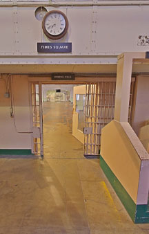
Alcatraz cellhouse had a corridor naming system named after major American streets and landmarks.
Link Location Gps / Gps Link -122.4226519 / Gps Link -122.423051 / Gps Link -122.423027
Gps Coordinates / 37.8263969,-122.4226519 / 37.8267827,-122.423051 / 37.8267637,-122.423027
Michigan Avenue was the corridor to the side of A-Block.
Link Location Gps / Gps Link -122.4230023 / Gps Link -122.4229776 / Gps Link -122.4229513
Gps Coordinates / 37.8267441,-122.4230023 / 37.8267242,-122.4229776 / 37.8267026,-122.4229513
Broadway was the central corridor in which the inmates would assemble as they massed through Times Square (an area with a clock on the wall), before entering the dining hall for their meals.
Link Location Gps / Gps Link -122.4229259 / Gps Link -122.4229008 / Gps Link -122.4228486
Gps Coordinates / 37.8266816,-122.4229259 / 37.8266616,-122.4229008 / 37.8266206,-122.4228486
Broadway separated Block-B and Block-C and prisoners kept along it had the least privacy in the prison.
Link Location Gps / Gps Link -122.4228486 / Gps Link -122.4228232 / Gps Link -122.4228003
Gps Coordinates / 37.8266206,-122.4228486 / 37.8266008,-122.4228232 / 37.8265819,-122.4228003
The corridor between Block-C and the library was called Park Avenue.
Link Location Gps / Gps Link -122.4227756 / Gps Link -122.4227487 / Gps Link -122.4227229
Gps Coordinates / 37.8265622,-122.4227756 / 37.8265408,-122.4227487 / 37.8265199,-122.4227229
The Warden's House is located at the northeastern end of the Main Cellblock, next to Alcatraz Lighthouse.
Link Location Gps / Gps Link -122.4226979 / Gps Link -122.422674 / Gps Link -122.4226499
Gps Coordinates / 37.826499,-122.4226979 / 37.826479,-122.422674 / 37.8264591,-122.4226499
The three-story cellhouse included the four main cell blocks – A-block through D-block, the warden's office, visitation room, the library, and the barber shop.
Link Location Gps / Gps Link -122.4226273 / Gps Link -122.4226001 / Gps Link -122.4227326
Gps Coordinates / 37.8264405,-122.4226273 / 37.8264259,-122.4226001 / 37.8263758,-122.4227326
The main cellhouse was built incorporating some parts of Fort Alcatraz's citadel, a partially fortified barracks from 1859 that had come to be used as a jail.
Link Location Gps -122.4225931
Gps Coordinates / 37.826557,-122.4225931
This building was modernized in 1933 and 1934 and became the main cellhouse of the federal penitentiary.
-
We left some touring brochures below let us know how you got along.
.
Freetoursbyfoot.com/alcatraz-tours/
.
Alcatrazislandtickets.com/Alcatraz-Island-Tours/
.
Thetourguy.com/travel-blog/usa/san-francisco/alcatraz/how-to-visit-alcatraz-island/
.
Alcatraztoursf.com/san-francisco/city-tour


