Cheese Rolling Festival Trail Tour, Cooper Hill closed for most of year to limit hill land erosion for future contestants
Link Location Gps ← Find Best directions
Gps Coordinates / 51.831747,-2.157228
Cheese Rolling Festival 2016 VR Trail Tour
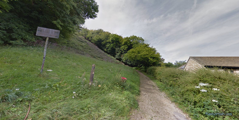
Coopers Hill, Little Shurdington, Gloucester
The Cooper's Hill Cheese-Rolling and Wake is an annual event held on the Spring Bank Holiday at Cooper's Hill, near Gloucester in England.
Link Location Gps / Gps Link -2.157272 / Gps Link -2.1573064 / Gps Link -2.1573389
Gps Coordinates / 51.831747,-2.157272 / 51.8317514,-2.1573064 / 51.8317515,-2.1573389
Participants race down the 200-yard long hill after a round of Double Gloucester cheese is sent rolling down it. The event was traditionally held by and for the people who live in the local village of Brockworth, but now people from all over the world take part.
Cooper's Hill 1995
Gps Coordinates / 51.831753,-2.157406
The cheese-rolling event returned on Sunday 5 June 2022, as the spring bank holiday was moved to June 2nd and was followed by an additional bank holiday, to create a four-day jubilee weekend in celebration of Elizabeth II's 70 years of reign. The event returned after a two year absence having previously been cancelled in 2020 and 2021 due to the COVID-19 pandemic.
Link Location Gps / Gps Link -2.1573707 / Gps Link -2.1574056 / Gps Link -2.1574404
Gps Coordinates / 51.8317516,-2.1573707 / 51.8317533,-2.1574056 / 51.8317509,-2.1574404
From the top of the hill, a 7-9 pounds (3-4 kilograms) round of Double Gloucester cheese is sent rolling down the hill, which is a length of 200 yards. Competitors then start racing down the hill after the cheese.
Cooper's Hill 2018
Gps Coordinates / 51.831719,-2.157619
The first person over the finish line at the bottom of the hill wins the cheese. The competitors are aiming to catch the cheese, however, it has around a one-second head start and can reach speeds up to 70 miles per hour, enough to knock over and injure a spectator.
Link Location Gps / Gps Link -2.1574762 / Gps Link -2.1575077 / Gps Link -2.1575444
Gps Coordinates / 51.8317488,-2.1574762 / 51.8317458,-2.1575077 / 51.8317231,-2.1575444
Multiple races are held during the day, with separate events for men and women.
Cooper's Hill 2015
Gps Coordinates / 51.831711,-2.157700
In the 2013 competition, a foam replica replaced the cheese for reasons of safety. The winners were given the prizes of actual cheese after the competition.
Link Location Gps / Gps Link -2.1575815 / Gps Link -2.1576206 / Gps Link -2.1576616
Gps Coordinates / 51.8317192,-2.1575815 / 51.8317191,-2.1576206 / 51.831714,-2.1576616
The Cheese Rollers pub in the nearby village of Shurdington, about 3 miles (5 kilometres) from Cooper's Hill, takes its name from the event.
Link Location Gps / Gps Link -2.1577007 / Gps Link -2.1577371 / Gps Link -2.1577765
Gps Coordinates / 51.8317104,-2.1577007 / 51.831707,-2.1577371 / 51.8317034,-2.1577765
The cheese currently used in the event is 3-4-kilogram Double Gloucester, a hard cheese traditionally made in a circular shape. Each is protected for the rolling by a wooden casing round the side, and is decorated with ribbons at the start of the race.
Link Location Gps / Gps Link -2.1578162 / Gps Link -2.1578513 / Gps Link -2.157883
Gps Coordinates / 51.8316981,-2.1578162 / 51.8316951,-2.1578513 / 51.8316863,-2.157883
Formerly, three cheeses were presented by parishioners, and the cheeses were usually rolled by them. A collection is usually made now to purchase them, as well as sweets, and also to provide prize money.
Cooper's Hill 2019
Gps Coordinates / 51.831647,-2.158017
Due to the steepness and uneven surface of Cooper's Hill, there are usually a number of injuries each year. A first aid service is provided by the local St John Ambulance (Gloucester, Cheltenham and Stroud Divisions) at the bottom of the hill.
Link Location Gps / Gps Link -2.1579145 / Gps Link -2.157938 / Gps Link -2.157988
Gps Coordinates / 51.83168,-2.1579145 / 51.8316684,-2.157938 / 51.8316523,-2.157988
Members of the local rugby club and Young Farmers volunteer their services by acting as 'catchers' for any participants who lose their balance and also are on hand to carry down any casualties requiring first aid who do not reach the bottom.
Link Location Gps / Gps Link -2.1580175 / Gps Link -2.1580491 / Gps Link -2.1580809
Gps Coordinates / 51.8316461,-2.1580175 / 51.8316431,-2.1580491 / 51.8316388,-2.1580809
A number of ambulance vehicles attend the event, since there is invariably at least one and often several injuries requiring hospital treatment.
Link Location Gps / Gps Link -2.1581247 / Gps Link -2.1581798
Gps Coordinates / 51.8316415,-2.1581247 / 51.8316528,-2.1581798
The event is traditional and takes its name from the steep hill on which it occurs. Until recent years, it was managed in a quasi-official manner by nominated locals, but since 2010 the event has taken place spontaneously without any management.
Gps Coordinates / 51.832883,-2.157108
This ceremony originally took place each Whit Monday, before it later was moved to the Spring Bank Holiday. The first written evidence of cheese rolling is found from a message written to the Gloucester town crier in 1826, even then it was apparent the event was an old tradition, and is believed to be at least six hundred years old.


